Version of June 23, 2023. This page is very much a work in progress.
For as long as Google has been Google, I have been using Google, because we early web users were happy to have it and we enjoyed playing with the DMOZ pages that initially guided its searches.
And for as long as users have been able to make Google Maps, I have been making Google Maps, embedding them on many web sites and blog posts. My most ambitious Google Map, in fact, has been a collaboration among seminar students and myself over close to a decade. That one is, naturally, coffee-related.
 |
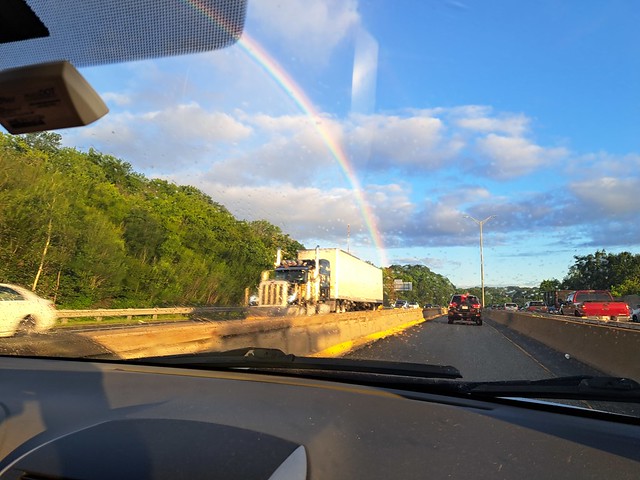
Image shamelessly lifted from 2023 Google MyMaps,
a 45-minute tutorial from GeoDelta Labs. |
When it first emerged, my experience with actual GIS software was fairly recent. I had been the first person to teach it at the University of Arizona and had been taking some online courses to remain current. Over time, though, my GIS skills have faded, so that I have relied on colleagues and students when spatial analytic heavy lifting is needed. Google Maps works only with point data, after all, and has no analytic capacity beyond measuring the distances between them.
For many instructional purposes and planning purposes, however, it is just what the doctor ordered (in this case, a doctor of geography). And order it I have -- for tracking personal life lists, planning family trips, illustrating stories or song lyrics, and much more.
A beautiful thing about these maps is that they are easy to update, and old links will take users to the most recent information.
(NOTE: My high praise does not mean that I believe Google is always correct. On two occasions, I have provided the company with corrections where map errors might cause problems for users not familiar with the locations involved.)
I recently decided that I would like to be able to send readers to the "My Maps" screen from which I can access all of my maps, but apparently this is not possible, and Google has not yet responded to my suggestion to make it easy.
So I'm providing a lightly annotated, slightly kludgy version of my directory, in no particular order. The thumbnails and descriptions below are augmented by more complete descriptions on the map pages themselves. And MANY of the locations on the maps include links to site-specific information I have created.
Please enjoy these and let me know if you create any maps of your own.
A "busman's holiday" refers to a vacation taken by a person to a place involved in their own professional work, as with a tour-bus driver going on a bus tour. We use a similar term whenever My Favorite Librarian visits a library while we are traveling. Bus Person's Libraries is a partial life list -- mainly for Pamela -- that includes at least one memorable library I have visited without her.
GeoCafes is the most ambitious of my Google Maps and the one mentioned above. It is the companion toe the eponymous GeoCafes blog, to which well over 100 students have contributed since 2012. Most of the map entries point to reviews by those students. I often rely on this to find local cafes while traveling, especially in Massachusetts.
Many people say that they never visit local sites of interest unless company comes from far away. Geographers are not those people -- as a group, we love exploration, locally and globally. The GeoDates Map grew from a conversation with a colleague and is a detailed guide to places our own Bridgewater geography students can visit, most of them at low cost and with less than two hours driving from campus. It accompanies the GeoDates blog post that provides many more details.

The National Park Life List map is a life list that I started during the pandemic, as I reflected on some of the places I've been lucky enough to visit -- National Parks of the United States and a few other countries. Along with National Parks, I include other kinds of sites managed by the National Park Service. As a practical matter, the distinctions are mostly minor. The only important distinction is that National Monuments are named by Executive Order rather than Acts of Congress and as a result may be removed from NPS oversight by subsequent presidents. Fortunately, we have only had one president petty enough to do such a thing, and he is out of office.

(October 25, 2023 update) An earlier version of this blog post showed a combined national parks and museum list, because for some reason, I decided to make museums a separate layer on the same map. I recently decided to give each category its own map, but it is still possible to do a bit of very low-key spatial analysis -- when viewed at the continental scale, it seems clear that I have found many more museums to visit in the East and many more NPS sites in the West.
Another October 25 update is that a student asked about museums in western Massachusetts yesterday and I realized that I was missing THREE in western Massachusetts and one in Connecticut, including the Eric Carle, which I had been to a half-dozen times. All better now, thanks to Taylor's question!
Good friends of ours in Bridgewater moved north about a decade ago to fulfill their dream of becoming innkeepers. In visiting their lovely inn over the years, we learned that many of there summer guests were on a 40-mile trek among four inns in their area, and that Vermont Inn Walking was an inn-walking tour that had been operating in the past and had been revived by a new generation of owners at the participating inn. We used this map better to envision our May 2023 journey and also to figure out which nearby sites we might be able to visit on the way to or fro. (Note: I deleted the homes of two friends in the area, one of which we did manage to visit.)

My father was not just an elevator mechanic; in many ways he was the elevator mechanic -- the GOAT of elevator mechanics. During the State of the Union Address, he sometimes sat in the Capitol, just in case. When the president of the United States needed a new elevator, he swapped shifts with another mechanic around the clock to get it done. Twice. Nobody could make a map of every place Jim Bohanan installed, maintained, or replaced an elevator. But since my mother's passing in 2020, I spend long mornings on the phone with him each week, often talking about his former work. And when a notable site comes up, I add it to this map.

My wife Pamela and I famously met in Maryland, where she had grown up and where Rachel Carson had done much of her scientific research and writing. Because Rachel Carson died the month before Pamela was born and they share a birthday, we think of them as perhaps sharing a mystical connection. Carson is mentioned in many contexts on Pamela's library-books blog and on this environmental blog, and comes up frequently in our teaching and outreach.
All of which is to say that Rachel Carson is an important figure in the Hayes-Boh household, but until very recently we had never visited any of the landmarks associated with her life and work. Her residence in Maryland was in the vague suburbs north of D.C. and her work was in an oddly rural zone intertwined with the sprawl of Baltimore, Washington, and a Naval Air Station. So when the whole family found ourselves staying at an Airbnb in the area in 2021, I decided to find those Maryland landmarks, and ultimately to map all of the Rachel Carson sites that I could find.
I first crossed the U.S.-Mexico border from San Ysidro to Tijuana as part of a very brief visit to Ensenada in 1985, a year after a massacre at a McDonald's on the U.S. side. The place had been very much in the news that year, but I did not realize how very close to Mexico it was until my friend Mike and I drove to the empty lot that had been the restaurant.
I next crossed the border at the very opposite end in 1989, when I had the opportunity to inspect a dry cleaner in the town of Mercedes, Texas. Several of us were qualified to do the work, but I asked for the assignment because I was beginning to become a bit specialized in the operations of dry cleaners and more importantly Pamela and I had spent the previous summer in central Mexico, and I was interested in returning to the country. As I often did on such inspection trips, I got a room and a car for several days, and did as much exploring as I could after hours, and I managed to find a place to park in Brownsville and walk across the border to Matamoros.
Author Tom Miller (for whom Pamela would eventually work as a research assistant) had made a point of making absolutely every crossing as he prepared his 1981 masterpiece On the Border: Portraits of America's Southwest Frontier. My experience will never be as complete as Miller's had been, nor would I enjoy trying to fill the remaining gaps in my own map. Both Miller and I (and Pamela -- who has crossed everywhere I have, except San Ysidro) crossed, the United States was still a country that greatly valued freedom of movement. Crossings were always subject to inspection, of course, but the militarization of the border did not begin until the 1990s, and of course it was amplified after September 11, 2001.
Thanks to those readers who have stayed with this map description for so long. I only spent about a tenth of my life (so far) in the borderlands, but the experience was profound. Since moving more than 2,000 miles from the nearest point along the border, I have made it my mission to inform other folks in the U.S. about its myths and realities. A search of my phrase human sieve on this blog points to more than a dozen entries about the complexities of that line.
For now I will add that a writer were were privileged to know during our time in Arizona helped me to think more positively about the region, despite the efforts of politicians, criminals, and pundits to make it something different. In Border People, Oscar Martínez describes a zone that is neither exactly Mexico nor exactly the United States. I read the book when I knew Oscar and lived in the region; I think it might read today more as history than anthropology, as many of the comings and goings he describes would now be difficult if possible at all.

Among the many, many disappointments in 2020 was the postponement and eventual cancellation of our nieces fancy wedding in Scotland. I have not been in western Europe at all (outside of Heathrow Airport) and Pamela had not been since the 1980s. So we had extensive plans to explore while "in the neighborhood" for a wedding that would have taken place where my forebears lived in the seventeenth century. I am holding on to the wedding travel map against the day we make this a retirement outing.

Since 2008, I have been part of a geography outreach project we call Project EarthView, in which we take a giant inflatable globe -- a sort of portable geography classroom -- to schools. The program later expanded to include giant floor maps, and has given us the chance to talk about geography with well over 100,000 students, their parents, teachers, local officials, and reporters. A few years into the project, I decided we should map the places we have been. I have done my best -- with the assistance of colleagues who have been part of the program -- to include every place we have taken the globe on the EarthView Experience map.
Fun fact about scale: to avoid any ambiguity, wherever possible, I have placed the Google location marker precisely on the building -- and the part of the building -- where we set up the globe. At a small scale, a viewer can see which towns we have visited. Zoom in to a larger scale, and one might see that we were in the eastern half of a big gymnasium.
This map is a bit silly -- Across Two Fridays is a subset of the EarthView Experience map shown above, because I wanted to document a particularly busy week in our life of geography outreach. Between two Fridays our team visited six schools -- elementary, middle, and high schools -- none of which was near any of the others. We scrambled a bit extra that week, squeezing in a visit to King Philip Middle School in Plainville to surprise Sathwik Karnik, who had won the 25th National Geography Bee with Alex Trabek just a few weeks before.

In a sense, the Marshall School Families map flips the EarthView script. We use our big globe to help bring conversations about the wider world to a local school. The EarthView Experience map shows all of the places we have done so. Marshall School is a wonderful neighborhood school in Quincy, Massachusetts. During a visit there, we gradually realized that much of the world was represented in that school -- so much so that this map represents just the fourth graders we met on that one day. Each marker points to the capital of a country mentioned as their family's home country by one or more students.

I created the Brockton Walking Tour, October 2016 map for a one-time walking tour of the nearby city of Brockton that I led for an interdisciplinary group of BSU Honors students. Several years before, I had taught a First-Year Seminar about the city, but it had a minimal field component. I later revived the course as an Honors FYS with substantial field experiences, as described in Brian Benson's 2019 City Champions article. This map is greatly in need of some development. I points to locations without any elaboration; I hope to involve students in my Fall 2023 class in connecting the map to some more information, including some Sidewalk Survey recordings I have already put on YouTube and some bibliographic connections to local experts who helped me plan that original tour. 
I created Geography of Coffee - BSU in Costa Rica to document the places we visited on my most recent travel course, when my friends at Matagalpa Tours -- who had co-taught most of my Nicaragua travel courses -- arranged a wonderful program in Costa Rica. When we made this trip in January 2020, I had no idea that it was to be my last international travel for more than three years.
Geography of Coffee in Fogo is a planning map for my next travel course, in which my colleague Angelo Barbosa and I will explore the small but fascinating coffee industry in Cabo Verde (Cape Verde). Many of the world's best coffees grow on the slopes of dormant volcanoes. To my knowledge, Fogo (Fire) is the only place in the world where coffee is grown in the caldera of an active volcano. Whenever it erupts, people leave and then return, perhaps to a different part of the crater. If you are reading this during 2023, please click the link above and consider joining us!

I spend a lot of time in schools, and many of the teachers I work with have told me they would love to take my coffee travel course, but they cannot go on my January courses, which coincide with the Central American coffee harvest. So I checked the world harvest calendar, saw that Peru would be good for a summer class, and then worked with my colleague Dr. Rob Hellström to develop a course that would involve coffee and his ongoing climate research projects in Peru. We did get a few of our BSU students to sign up, but no teachers. That was 2017; we would love to try again some time. Let me know if you are interested enough to put down a deposit on such a course.
My Peru map includes a layer based on the as-yet-imaginary travel course mentioned above and another layer based a birthday trip to Machu Picchu with my favorite librarian in 2014. After three decades of travel, study, and work in Latin America, this was the first experience in the Andes for both of us. We made a point of finding lodging a bit out of the way from most of the tourism. We stayed in and traveled among many locations in which Spanish was not even the dominant language. It was delightful!
The fact that neither of these extensive trips would have anything in common except for the Lima airport reminds us that Peru is rather a large country, as shown above on an image I created on TheTrueSize:
As soon as a new dean for continuing education (at BSU this means anything not taught 8-4 in a regular semester) announced that he was allowing for summer courses that would be taught in just 5 eight-hour days, the idea of Coffee Week was born. At first, I thought I would do some lectures and show some movies all week, and then visit a roaster and café or two. By the time summer had arrived, this had become a full-on coffee crawl. As Coffee Week 2016 shows, we went to so many cafés that the students were refusing free coffee by the end of the afternoons. We learned a lot and the students took some terrific photographs! (Most of these businesses are still in business, but sadly some cafés on this map no longer exist, so check ahead before you travel to any of them.)

As the name implies, Coffee Week BSU 2017 is a map of the places we went during the course's second offering -- it was just as enjoyable. Although we tried to offer it a few more times, we were never able to gain enough enrollment for the course to run again. In-person summer classes were very difficult to fill even before Covid-19. I do not think we will be able try this concept again.
BSU Nicaragua is a simple map with a brief title, but there is more experience behind this map than any other I have made. Anything I do related to coffee began with my decision to take students to Nicaragua in 2006 -- just one time, I thought.
A search for Nicaragua on this blog will bring scores of articles, most of which relate to some place I have visited on this map, and a dozen of the albums in my Flickr account are from the trips represented here. Between 2006 and 2018, I took 12 student groups (with occasional friends or family included) on travel courses -- well over 100 people, some of them 2-3 times. None of them went to every site on this map, but all of them went to most. And of course, each site on this map is full of memories for me.

And now back to some teaching that is not coffee-related. The GEOG 332 shows only four points, all of which I have visited and two of which are field-trip destinations in my course GEOG 332: Land Protection. As I prepared this blog post, I decided that annotations for those points would be a good addition. Feel free to click through to see a bit of what this course is about. I am fortunate to have taught it in alternate fall semesters for more than 20 years. I am looking forward to the next time, starting in September 2023.

The Global Guardians map is another example of a map connected to a specific, non-coffee course. In this case, the map was created with the direct assistance of students in a course. GEOG 130: Environmental Geography is a survey course that is central to my identity as a geographer. In the early days of Google, simply searching on the title of the course would bring up my web page as the very first result (a parlor trick I cannot do any more). I have taught the class more than 100 times in many different formats. For the past decade or so, my main textbook has been The View from Lazy Point by the amazing Carl Safina.
Of all the approaches I have taken to this course, I have found to be the use of his book to be the most successful. But a few years ago, I realized that the combination of his text and my teaching did not allow sufficient space for non-male voices in what should be a comprehensive discussion. As I describe in my 2020 Guardian Women blog post, I found a rich array of female environmental leaders to introduce to my students. My favorite librarian helped me to develop a series of assignments to deepen those introductions and one result is a map that my students made to show where some of those women lived and worked.

The Bridgewaters Project map points to every place I know of that shares its name with the town where we have lived and worked since 1997. Soon after moving to Bridgewater, Massachusetts we learned that it is named for Bridgwater (sic), England and also shares a name with Bridgewater, Nova Scotia. Gradually, we learned that quite a few states have a town (or several) with the same name, and that many smaller places (like shopping malls) also share it. Thus was a quest begun, and in 2009 we began the Bridgewaters Project blog, documenting Bridgewaters we had already been and giving us an excuse to visit others. Our local newspaper eventually learned what we were up to and sent a reporter to write about it and take a wide-angle photo of us in our hallway full of Bridgewater prints and maps.

As mentioned above, the Bridgewater in Nova Scotia is of particular importance in our Bridgewaters Project, so our 2018 visit there was a big deal for us. We spent a couple of nights in a perfectly lovely B & B in Bridgewater itself. We also visited some truly amazing places on our way to and from Bridgewater and quite a few others in the vicinity. We would love to go back, and not just because of the incredibly warm welcome we received in the local historical society. Of course, our Bridgewater, Nova Scotia blogpost has a lot of fun details, and the Nova Scotia 2018 map was essential to the journey.
Mermaids might be the silliest use I have made of Google Maps so far, only because there are several levels of family-blogging absurdity involved. The map is embedded in a post on our Bridgewaters Project blog, which in turn is referenced in the Mermaids entry on our All Noni blog. For those readers who are new here, the former is about our determination to write about all places named Bridgewater and the latter is about our determination to write about every film, television show, or short work involving Our Noni, otherwise known as Winona Ryder.
For the past several years, I have taught one-credit Honors colloquia about cities that interest me greatly but that I had not visited when I started this practice. Initially, I offered Detroit and New Orleans because they were the U.S. cities about which I had done the most reading and thinking, music listening and film watching, without having actually visited. Even a lot of cities I had visited in person had not captured my attention so much. I have since visited Detroit for just 21 learning-packed hours, but I have not made it to NOLA yet.
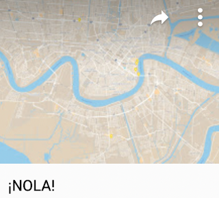
I bring a lot of maps into these classes and I have students bring in even more. The simple
¡NOLA! map shows just one kind of thing: the locations of international consulates in New Orleans. It seems to have a lot of consulates for a city its size, and they are not random. Rather, they reflect the places to which New Orleans has had -- and continues to have -- the most important connections through trade, migration, and cultural exchange.

The
Chan Chan map is similar to some of the others mentioned so far, in that it shows the places mentioned in a work of art, in this case a song by the same name. Not just a song, though: the song that has come to represent an important moment in Cuban music and the performers who represent that moment:
Buena Vista Social Club. In this case, the map arose from my own curiosity about the song -- I could not decipher its meaning until I figured out which words were place names. I embedded the map in my 2013
Hoguín Son post. (That is the Spanish word "son" for "sound" not the English word for a male heir.)
I made the Garifuna map for students in my New Orleans class. It has just three points, but they are important for understanding the geography of Garifuna language and culture in the Caribbean region.

I hope that people are still aware of the story of Malala Yousef, a Pakistani woman who was nearly killed about a decade ago for pursuing an education and whose courage captured the imagination of millions. My first blog post about her was my 2014 Crisp and Self-Assured, which had to do with pundits like Rush Limbaugh supporting her attackers. When I wrote Riveting Malala a bit later that year, I created the map Malala Locations from the Memoir, because her book mentions many places that are not at all familiar to most of her readers. As with any of my maps, the idea is not simply to notice where the points are, but rather to use these maps as a point of departure for further exploration. Once we know where various events in her life took place, we can use these and other maps to learn more about those places. Are they hot, dry, steep, flat, forested, urban, rural -- what kinds of places are they?

The Malbeclipse 2019 map describes personal travel with a complicated story that began with a jury-duty summons two years prior. Pamela had received a summons for federal jury duty that would have disrupted the long-planned (and very geographic) celebration of our 30th wedding anniversary. The feds let her off the hook, but stressed that there would be NO MERCY during the make-up week a few months later. So when friends invited us to return to their home in Kearney, Nebraska for a total eclipse of the sun, we declined so that Pam could call the court every night.
Of course, she was never seated on that jury, but our hopes were dashed. This geographer immediately set about searching upcoming eclipses and noticed that a 2019 event would be very close to Mendoza, Argentina -- an Andean town that is the source of most of the red wine we drink in our home -- Mendoza Malbec. As we were making plans, I was fortunate to meet someone from Chile who convinced me that the Elquí Valley of Chile would be a better viewing area. It is home to one of the world's most important clusters of astronomy researchers because of the incredibly clear skies at the edge of the Atacama Desert. So the question was: Argentina or Chile? The answer was: yes, both. We went to Chile for the eclipse and then flew to Argentina for the wine. We did not lack for wine on the Chilean side of the mountains of course, but we had our hearts set on Mendoza! The Malbeclipse 2019 map includes some details about our lodging and transportation and also the half dozen or so vineyards we visited.
Bonus: I just added an icon to this map for our next visit. We need to return to both sides. I would love to spend a month or so in Elquí and we also need to get to the Gabriela Marquez museum that was closed the day we tried to visit.
On the Argentine side, we visited quite a few vineyards, including one in the distinct Uco Valley district to the south of Mendoza proper, but we left about 250 vineyards unvisited. We were also there in southern winter, and I wonder how crowded the entire area must be in peak season. The icon I have added is not for any particular vineyard in Mendoza -- though we do have some favorites. Rather, it is for another growing area -- even higher in elevation and well to the north: Salta. We have had a few exquisite wines from there. Moreover, an image I recently found on the Descubre Argentina tourism site suggests the kind of alpine village scene I had imagined but not found in Mendoza. I'm willing to give it a try!
Onyema Ogbuagu is a map that is named for a person -- a person whose name recognition is tiny (even I had forgotten why I made this map) despite the immense importance of his contribution to global well-being. As I mentioned in my 2020 Thanks to Doctor Ogbuagu blog post, he is a Yale researcher who played a vital role in the development of a Covid-19 vaccine that saved millions of lives and allowed billions of people to return to something like normal living after the global pandemic. His biography mentioned several academic sites throughout Nigeria that were unfamiliar to me, so of course I made a map!

Those who click on my Georgia Planning map (and I hope that includes whomever is reading right now) will notice that this is, as we say, Georgia the country, not that place where we keep Atlanta. This is the former Soviet republic on the Black Sea that a certain crazy man in Moscow has made some efforts to reconquer. It is mountainous country of great political and geological complexity, considered equally Asian and European -- neither and both, in the minds of many.
We have been learning a lot about Georgia since 2017, when we hosted a Georgian geologist in our home for a couple of months while he used our university's facilities for some fascinating work trying to untangle some of that geology. We were fortunate that he returned for a brief visit a couple years later and that we have stayed in touch online. (No worries -- on our part -- that Georgian is an extremely unusual and difficult language. Our friend Luka is fluent in at least four languages, one of which is English!)
Among the interesting things we have learned is that Georgia is the FIRST place on the planet to have made wine; those who have been paying attention will know that this alone is reason enough for a Hayes-Bohanan visit. We are also interested in some outreach related to geography education and simply visiting Luka and other Georgian friends in their home country. So far this is a planning map with no date (Covid-19 threw us off some former plans), but definite strong intentions. (Fun fact: Tbilisi is one of three national capitals on the same latitude as our home near Boston.)
The Puerto Rico 2016 map began as a planning map but now serves as an annotated record of our visit that year, including a link to all of my photos from the journey. So far this is the only time any of the Hayes-Bohs have visited the island, which would be the 51st state already, were it not for the opposition of Kentucky Senator Mitch McConnell, our country's most effective bigot.
Our son went to the sort of school where the parents' fundraising auction included fancy vacations, and we decided to splurge on an offer of a few days in a villa on the north coast of the island. It is not the sort of place we would normally vacation on our own -- the offer was somewhat off-season, so we had not only a huge villa but almost an entire gated community to ourselves. No complaints, though: it was beautiful, comfortable, near the ocean, and convenient for exploring much of the rest of the island.
The map includes a description of each of the sites we were lucky enough to visit, a year before Hurricane Maria and a criminally negligent federal response destroyed many of these sites. A search of this blog for the word Boricua points to more of my pointed remarks about the treatment of my fellow citizens on the quasi-colonial island. I also recommend the documentary Yo Soy Boricua Pa'Que Tu Lo Sepas! (I'm Boricua Just So You Know) by comedienne Rosie Perez -- see IMDb entry or the entire film on YouTube. It was made in 2006 but remains the best introduction I know to the island and its connections to the mainland.
Just added in Spring 2026: HBA means Hayes-Boh Airports (it is also the real code for Hobart, Australia).
This map locates every airport to or from which I have flown -- either as a destination or as a layover. Each one has a story! There are also just a few airports where I have not been a passenger, but for which I have a comment -- these are in orange.
I am fortunate to have lived in many parts of the United States and briefly in Mexico, Brazil, and Nicaragua. The Todas las Casas map locates all of these homes. This includes nine "Love Shack" locations with my spouse. It was Love Shack #9 to which we returned one evening, after hearing these folks perform the song in our favorite theater.
A related map is on my Trip Advisor profile -- it shows many of the places I have visited.
MAPS TO COME!! I have a few more to share, and I often get motivated to make new ones. There is no better form of procrastination for a geographer with a nostalgia problem.
 Geography asks three questions: