Showing posts sorted by relevance for query detroit. Sort by date Show all posts

Tuesday, July 18, 2023

Detroit Recovery

It has been a decade since the City of Detroit declared bankruptcy, leaving its "citizenry" vulnerable to the whims of fiscal overseers. The scare quotes in the previous sentence are made necessary because citizens whose municipal affairs have been placed in the hands of unelected outsiders are not fully enfranchised. 

The Detroit Public Library is one of the city's treasures;
so to are its librarians, who were among the public
employees whose pensions were raided by the
bankruptcy managers.

I began following the progress of Detroit around that time for several reasons. First, its fiscal demise had a very specific kind of spatial dimension, as population loss sharply reduced population density, which then made the provision of services increasingly expensive on a per-capita basis. This dismal feedback loop ultimately led to the bankruptcy. 

I was further interested because of the important insight my son shared in an undergraduate research paper about three years into the bankruptcy. The suits (that is as polite a term as I can muster) decided that a city with fiscal difficulties did not deserve great art. That is, the city's financial overseers threatened to sell off the treasures of the Detroit Institute of Art and other city assets, placing the short-term interest of creditors ahead of the long-term interests of the citizens.

This is all prelude to Quinn Klinefelter's report on today's NPR Morning Edition, entitled How is Detroit doing 10 years after it filed for bankruptcy? Please listen to his comments, which I would describe as Detroit coming back slowly and unevenly from its low ebb a decade ago. In my view, the unevenness of this recovery is a microcosm of inequity in the country as a whole. From my very brief visit last summer, I can confirm that the entertainment district described in this story is doing much better than the rest of the city. 

To the degree that the finances of the city itself have recovered, it has been on the backs of public workers. Teachers, librarians, and other municipal workers had their retirement benefits stolen. Even uniformed public employees (police and fire) were ripped off, though not as deeply. 

For those who are interested, a search for Detroit on this blog points to some resources about this most important of American cities.

Thursday, July 28, 2022

Detroit Museum Visit

I have been teaching Detroit: Arts City for several years, without having ever been to the city. Some people are surprised, because a lot of my teaching is about places I have been. Finally getting back to Chicago and Wisconsin for family visits last week, 

I was glad when my spouse suggested a stop in Detroit. We saw as much as we could manage in just 21 hours, mostly in two of the city's many museums: Detroit Institute of Arts and Detroit Historical Museum. The former is a global treasure -- the fact that bureaucrats seriously considered selling off its contents as a "rescue" plan is what got me interested in the study of the city in the first place. My son wrote a most excellent paper arguing against this deeply flawed and ignorant plan.

These are two institutions that tell a lot of stories, so my snapshots hardly do either of them justice. Still, for those who have never been, I hope that the slides below from our quick visit will inspire an appreciation for some facets of this remarkable city and its cultural treasures. 

Please click the right arrows to advance slides, and click the ... three dots below each image to expand the captions. Apologies that Flickr "updates" do not make this a bit more user-friendly. You can also go directly to the Flickr album if that works better for you or you want to look at a single image more carefully.
Detroit: Arts City in 21 Hours
I look forward to sharing these with my honors colloquium students in the fall.

Rosa Parks, Detroiter

Rosa Parks is one of the most famous participants in the Great Migration, but most people who know her name do not know that she migrated! This included me until very recently, when I learned about her experiences in Detroit, where she spent a bit more than half of her life. 

Icon of civil disobedience: justice sometimes
requires breaking unjust laws.

Despite the success of her role reducing racial discrimination in Alabama by challenging segregation on buses in 1955 -- perhaps even because of that success -- she was unable to find work there and was forced to escape, first to Virginia and then to Detroit, Michigan. There she worked for U.S. Rep. John Conyers for many years. 

After retirement, she was assaulted in her own apartment and forced to move. Little Caesars Pizza mogul Mike Ilich privately paid her rent for many subsequent years, though this arrangement seems to have ended during her final years.

The logo I have seen in 2-D throughout
the USA is 3-D throughout Detroit,
even in the Detroit Historical Museum.


Sunday, October 27, 2019

Detroit Arts City


It is time to propose one-credit honors colloquia for next fall, and I was beginning to think that my next topic should be Detroit, with a focus on the role of the arts in the social and economic development of the city. My kid -- an accomplished artist and honorary geographer -- had introduced me to the importance of this question a few years ago, with a brilliant paper in response to the proposed liquidation of some of the city's great museum collections.

The decision was made for me just now, by an instructive review of Detroit's proto-punk scene on PRI's Studio 360. As part of its American Icon series, journalist Pedro Rafael Rosado makes a convincing case for the pivotal importance of the 1962 one-hit wonder 96 Tears by Question Mark and the Mysterians.
Visual arts will figure just as prominently in our colloquium,
including Diego Rivera's Detroit Industry Murals,
completed thirty years prior to the music featured above.

Monday, January 09, 2023

Detroit: Roll City


Image: Zairé Talon Daniels via NPR

Shortly after concluding the latest session of my Detroit: Arts City honors colloquium, I heard this delightful story on NPR's Morning Edition. Journalist Naina Rao reports on Detroit style skating, whereby Motown music combines with exercise to help build community.

Tuesday, October 20, 2020

Belle Isle Memorial


Belle Isle -- Beautiful Island Indeed

In the middle of the Detroit River -- between the Detroit waterfront and the Riverside Drive in Windsor, Ontario -- Belle Isle is a small island beloved by the people of Detroit. 

It was therefore the perfect place to memorialize Detroiters who have been lost to the Coronavirus pandemic. It seems especially fitting that the memorial would take the same form as many other ceremonies this year -- a car parade. 

Lagniappe

Near the end of the story, people wax nostalgic about the radio program of Martha Jean McQueen. Her prayerful pronouncements voiced over the music of Rev. James Cleveland are typical of the excerpts I could find online. 

Wednesday, September 28, 2022

Buffalo and Other Climate Havens

Buffalo, New York declared itself a climate have in 2019 and has an Office of New Americans to facilitate its role as a place of welcome. In yesterday's episode of On Point, journalist Kimberly Atkins Stohr brings together an impressive array of guests -- from planners and scholars to a recent climate refugee in Buffalo itself -- to examine the many geographic implications of climate migration in America.

America’s Climate Havens of the Future begins with the story of Maria Agosto, a refugee from the eponymous hurricane that drove her from her home in Puerto Rico to her new home in western New York. On  Point is always worth listening to; this episode is worth listening to twice -- and taking notes. Some of its lessons are in my own notes below.

This photo from Isle of Jean Charles, Louisiana accompanies the podcast. As I mentioned in my 2016 article Climate Attack, this community may have been the first in the U.S. to be abandoned entirely because of climate change.

Sociology professor and demographer Matt Hauer describes lessons that are already beginning to be learned about the migration of humans because of environmental push factors. His own research focuses on migration that is likely to result from rising seal levels, and he is well aware that other consequences of climate change will also result in migration. Some patterns are counterintuitive, though: as dangerous as increased temperature itself is, a lot of migration is toward such urban heat islands as Atlanta and Austin, which exhibit pull factors that will continue to further their growth. 

His models estimate 13 million migrants resulting from rising sea level alone. During the interview, he explains why other serious hazards -- from wildfires to hurricanes -- do not necessarily drive significant migration. 

Beth Gibbons, executive director of the nonprofit American Society of Adaptation Professionals, says, "the past is no longer a good guide for what the future is going to look like." In some ways -- such as flood modeling -- the past is not even a good guide to the present.

Both Hauer and Gibbons note that a lot of migration continues to be stepwise -- people tend to move to nearby places where they might have some social capital before they make long-distance moves to places where they have little prior connection. The story of Maria Agosto and her family is an exception that may become increasingly common. Planners in Buffalo, in fact, are counting on it. 

The city is already known as a welcoming place and is embracing its potential as a climate haven. Even the most welcoming places are working to mitigate aspects of rapid growth on housing affordability, indigenous communities, suburban sprawl, and more.

During the program, Missy Stultz, sustainability manager for Ann Arbor, Michigan describes some specific ways in which her city is preparing for its role as a climate haven Geographers, by the way, are well prepared for exactly the kind of work she is doing. 

Gibbons points out that "legacy" (aka Rustbelt") cities of the north have the potential to benefit from climate-driven migration. She cites Detroit, whose population has declined from 1,200,000 to 700,000 and therefore has a lot of physical space for newcomers, but would need significant restoration of its infrastructure to return to anything like its former population.

She further describes how infrastructure investments can use both state and federal resources not only to accommodate new residents, but also to do so in more equitable and sustainable ways. Among the many specific details she mentions is the rarely discussed but increasingly dangerous problem of combined sewer overflow (CSO), which is just as nasty as it sounds. 

Lagniappe 

We have been here before, though for different reasons. The episode page includes a link to What Migrants Displaced By The Dust Bowl And Climate Events Can Teach Us, a 2018 article by Francesca Paris on Here & Now Compass.

Thursday, June 26, 2014

Cochabamba, Michigan

Access to water is an increasingly important area of contention between property rights and human rights. As best exemplified by the standoff between Bechtel and the people of Cochabamba, Bolivia, it is increasingly difficult for people to get access to water -- the substance that makes up most of our actual bodies -- without contributing to the concentration of wealth.

Now Al Jazeera America reports that the United Nations is now considering access to water in Detroit a serious human-rights concern. Thousands of residents have had water cut off because of unpaid bills. Some have defended these measures as necessary steps taken against "deadbeats," but this seems to miss a fundamental question. If water is a basic need, should it not also be a basic right? Those who fail to pay taxes can, after all, still breathe the air and even walk on sidewalks and drive on streets. The problem is that water has not been made universally available in the same way, so that a matter of bill collection can quickly become a matter of life or death.

Thursday, October 08, 2009

Jobless Recovery


Job seekers fill out applications for positions at a new bar and restaurant while standing in line in Detroit, Sept. 25, 2009. (AP - Posted on OnPointRadio.org)


Through geography -- particularly environmental geography -- we find that everything is connected. The human impact on the environment, for example, is inextricably linked to the economy. Economic geography analyzes spatial patterns of economic activity -- what humans produce where, and why they do so.

To understand economic geography, it is important to know something about financial systems, business cycles, and the connections between each of these and employment. Reliable and cogent discussions of these are difficult to find. That is why I was pleased to hear this hour-long discussion. On Point Radio host Tom Ashbrook leads a very informative discussion with Robert Reich and Elizabeth Warren. It is worth investing an hour to hear what they have to say about the U.S. economy at a critical crossroads.

Tuesday, September 28, 2021

#RangerBetty100

December 2025 update: Ranger Betty is one of those rare figures about whom we can say she was taken too soon, though she did live for 104 years and passed on the solstice after touching the lives of thousands. Her obituary on Berkleyside is one of many remembrances. From this one I learned that she was a musician, among her many other identities and achievements.

If you have only one hour to learn about the history of the United States, I recommend that you spend it with Betty Reid Soskin, National Park Service Ranger. (The NP Lego post below was in honor of her 100th birthday. As of this edit (July 2025), she is retired but still with us!)

I learned about Ranger Betty as many other people did, when the entire National Park Service celebrated her 100th birthday as part of the centennial celebration of the NPS itself. The occasion came to my attention in several different ways over a couple of days. The most fun, of course, was the item above from the impish creatives at NPS Lego Vignettes, from whom I literally learn something new every day.

She is a ranger at the Rosie the Riveter WWII Home Front National Historical Park in California. Her personal history is so deeply entwined in the mission and purposes of the park that they have created an entire web page for this particular ranger. The Betty Reid Soskin page included a schedule of the popular presentations she gave on site, a biography focused on her relationship to the park, and most importantly, that one-hour video I reference in the opening lines above. 

She is shown sitting as I've seen many rangers do in other parks, on a kitchen stool at the front of a small theater full of visitors. She introduces the park and the park's main documentary video. The hour spent with her includes about 20 minutes with that professionally produced film. It begins, however, with her presenting both a general introduction to the concept of urban national parks and her own connection to this one. After the film is when the real learning happens: in a series of firm but gentle steps, she guides listeners from a superficial understanding of what the home front was all about to a deeper understanding of how that reality was shaped by race and how that might be relevant today.

Spoiler alert: although she was born in Detroit, a key turning point in the life of Ranger Betty Soskin was the evacuation of her family from a flood that ravaged much of Louisiana. Most of us were not aware of it until after Katrina in 2005, though Randy Newman ... and later Aaron Neville ... told us all about it in Louisiana 1927, first released in 1974.

UPDATE: I returned to this post in July 2025 because I happened to hear one of Ranger Betty's talks on The Moth. I recommend both of them! This also led me to read the rest of her story on the Betty Reid Soskin Wikipedia entry.

Lagniappe

If you have more time to devote to learning about the Great Migration that is a big part of Ranger Betty Soskin's story, I highly recommend Isabelle Wilkerson's The Warmth of Other Suns. She focuses on the stories of three families in order to provide a few in-depth examples from among the myriad experiences of millions of Americans moving over a period of half a century. For a link to the book and my own thoughts on it, please see my Warmth of Other Suns review on Goodreads.

I found the Ranger Betty video while I was looking for material about this book; I found it a bit after the fact. Wilkerson was featured on the TED Radio Hour, which includes a conversation with her and a link to her TED Talk.

Wednesday, June 17, 2020

Discovering Our Own Neighborhoods

Atlas Obscura is always a trove of geographic insight; the geographically curious can spend hours perusing the online or print version.

A recent contribution by journalist Lauren Vespoli offers even more to the geographically curious (including hints as to how and why we should all be geographically curious). In How to Dig Into the History of Your City, Town, or Neighborhood, she describes how she has used newly-found down time to explore her own surround -- and to engage friends to do the same. This is very creative online bonding! As she makes clear throughout the piece, the history comes in many forms and so do the processes of discovery.
Geographic discovery involves inquiry about
the ordinary in our midst.
She describes several tools that are familiar to me as a professional geographer -- such as Sanborn maps -- and other fascinating tools I had never heard of. I am most excited about using the Archipedia, which has well over 100 listings in each of two cities I teach as honors colloquia -- New Orleans and Detroit. Sadly, none of the fascinating buildings of Brockton (about which I teach an honors seminar) are this database, but I have other resources for exploring that city formerly known as North Bridgewater.

Among the tools Vespoli introduces is another I learned about from a fellow geographer just recently. Mapping Inequality is an impressive online collection of the maps used by the Federal Home Owners' Loan Corporation to guide mortgage rate-setting. In the guise of managing institutional financial risk, these maps also imposed or reinforced geographic patterns of racial discrimination through the practice of redlining. For many communities across the United States, researchers can discover whether their own neighborhoods fell inside or outside of those red lines.

I will also use this in my course Environmental Regulations, because this kind of research -- while enjoyable in its own right -- is potentially quite useful in some of the detailed work necessary to protect us from environmental contamination. Because pollutants from the past can be just as dangerous as chemicals currently in use, searching for possible relict sources of pollution is an excellent application of geographic skills.

Monday, November 21, 2016

Just Read

Lifted shamelessly from Instagram.

Expert guidance on this topic from my favorite librarian: BBW MaxGuide.

Civil-rights leader and U.S. Congressman John Lewis cites the value of reading and libraries and teachers on the occasion of accepting the National Book Award in 2016. (October 2023 note: I am incredulous that this video has only been watched 20,000 times since then -- many of those times by me. Please share this widely; every American should here what he has to say about the right to read!)


The movie Selma tells some of the story of this national hero. I highly recommend it! And I will be ordering the graphic novel for which he and his co-authors won this award: March: Book Three (the link is to a boxed set of all three volumes; each volume is available in a couple of formats). To learn about the importance of this series, see Jody Arlington's review of the first volume, the Washington Post's announcement of the award for Book Three. I also recommend his 2009 interview with Terry Gross, about the movement to win the vote.

MEMORIUM: Rep. Lewis died July 17, 2020 exactly a week before my own mother, who was an admirer of his. Although it is quite long at a bit more than four hours, I recommend the recording of his funeral, which I watched in its entirety in real time. He brought out the best in a wide variety of speakers and musicians.

Good writing stems from time spent reading. If I see what someone has written, I cannot tell whether they went to a "good" school or not. But I can tell whether they have devoted any serious attention to reading. For more on the connections between reading and writing, please see my How to Become a Better Writer page. It is one of several Writing Tips pages on my Not-the-13th-Grade web site. As "Dear Abby" Abigail Van Buren has written, "Those who do not read are no better off than those who cannot read."

For more on libraries, visit the web site or blog of my favorite librarian.

Lagniappe

Item #3 above refers to the skills ascribed to Christian mystic Edgar Cayce.

Update

In the same week that Rep. Lewis so eloquently articulated the importance of reading, other politicians announce their opposition to literacy. Michigan Gov. Rick Snyders -- and his education bureaucrats -- have argued in court that students in Detroit have no right to an education that would afford them basic literacy.

636152778937523737-FILE-classroom.jpg
Gov. Snyders doubles down on low-quality education.

All of this comes as the results of a study of information literacy confirms that students across a wide range of ages have difficulty discerning real news from fake news or opinion. When "my opinion is as good as your facts," reality becomes a very slippery concept. The Wall Street Journal report on this study cites educational "consultants" who blame parents for not teaching information literacy, even as it admits that high-stakes testing and the elimination of school librarians are the real culprits.

In addition to bringing information professionals back into schools and allowing teachers to teach there subjects rather than taking of tests, students should be encouraged at every turn to read both deeply and widely. The more we read, the less easily we are fooled.

Backlash 

Some of his contemporaries were not fans of Representative Lewis. In 2017 white supremacist Paul LePage, then governor of Maine, said that the Congressman not only needed a history lesson but also needed to apologize to the party that now actively opposes voting rights, because 150 years ago Republicans helped to end slavery. It was, of course, LePage who needed a history lesson. As of 2025, he is contemplating a run for Congress in Maine, even though he has retired to Florida.

Monday, June 04, 2012

The Worth of Children

Mike Thompson, Detroit Free Press
Mike Thompson's incisive cartoon about the contradictions between pro-child and anti-teacher rhetoric arrives just as the two sides are coming to a showdown in an unthinkably bitter recall election in Wisconsin.

Locally, teachers in the town of Abington recently decided to curtail voluntary activities after all other efforts to negotiate a contract had failed. I know from my own limited experience with this kind of "work to rule" action that it is difficult for most educators to limit themselves to the work for which they are actually paid. The intent, of course, is to help administrators to see just how much is done on a voluntary basis, with the hope that this will result in more reasonable offers for the work that is done for pay.

I recall a discussion as we considered such an action a number of years ago on my own campus. (We are almost always without settled contracts in Massachusetts, as disregarding higher-education seems to be a bipartisan sport of long standing, but we only take action in especially egregious circumstances.) As we discussed whether or not to skip graduation ceremonies, a colleague argued that we should do our best to shield students from our conflict with the Board of Higher Education.

In that moment, my own thinking on the question shifted. I had seen students as potential victims in the crossfire between faculty and our governing body, but I realized that the opposite was true. When schools and teachers are underfunded or treated with disrespect by state and local governments, they are caught in the crossfire between politicians and students.

And then I remembered something I heard years ago from a scholar who had recently returned from a research trip to Scandinavia. She reported realizing that the United States is really a country that hates children (and young adults, too, it seems). Our rhetoric, of course, is pro-child, and as individuals we would do anything for our children. Even anti-government nihilist Grover Norquist is indulgent with his own daughters.

Our collective deeds, however, all too often reflect a distaste for the children of others. We are indeed fortunate that teaching, social work, and child care continue to attract those who hold children and youth in higher esteem than the value implied by the typical pay for these professions.

Through my EarthView program and other activities, I work with enough teachers to know that there are some exceptions -- teachers who really should not be working with children. But in my experience these are rare. Most teachers I meet do amazing work with children (or youth or adults), despite the incredible barriers to teaching that are imposed by politicians, and despite pay rates below those of their non-teaching peers.

Tuesday, June 16, 2015

Mas Musica

It was almost a decade ago that I made a small tour of Massachusetts college and university campuses, speaking on the cultural geography of Latin American music. The tour was sponsored by  MaCIE, and allowed me to meet a lot of interesting educators and students around the state. I am not a musicologist by any means, but I do find that music often reveals a lot about cultural geography, and my presentations consisted in discussing some examples. I carried around our Bose CD player and a suitcase of CDs at the time, and very much enjoyed myself.

I continue to find and enjoy new examples of culturally interesting music that I share with my students, though I do not attempt to update the Musica web site very often, but I occasionally add something to the blog. And today is such an occasion, as I just found a list of 11 Latina musicians who exemplify the great variety of music in the region.

I embed Fiesta from Bomba Estéreo simply because it is by far the most colorful and among the most modern of the examples collected by Marcelo Baéz on music.mic, but I encourage readers to watch all of the videos he has shared.
I found this article just as I was sharing the film Selena with my students and discussing my experience of living in South Texas during her rise and tragic fall. Both that film and the song "Sorry I Stole Your Man" by Jessica Hernandez and the Deltas reminds us that many Latin@s in the United States do not speak Spanish fluently.
Together,they are a rich lesson on the dynamic music of Latin America.

Lagniappe
The radio program Latino USA opened 2016 with this conversation, in which we learn a bit more about the how Jessica Hernandez began her career, at first at home in Detroit and then on tour, which meant long drives to small audiences.

Friday, July 08, 2022

Water Deep Dive (The Takeaway)

I usually find The Takeaway from WNYC to be compelling radio. Even in the context of the general excellence of the program, the broadcast I am listening to on WGBH 89.7 is so exceptional,  that even as I listen, I am preparing this post as part of making the broadcast required listening for most of my classes.

Deep Dive: Water as a Human Right

Even if you are not in one of those courses, I strongly encourage you to listen to Water, a single episode in the program's Deep Dive series. As the title suggests, the scope of this episode is ambitious; one might even say daunting.

In just 48 minutes, journalists Melissa Harris-Perry, Dorian Warren and an impressive array of guests connect water insecurity in the United States to human concerns ranging from physical and mental health to racial inequality and political stability.

Their conversation stretches from Chicago and Detroit to the Navajo Nation and to the world beyond. The program ends with a serious of important questions about how we use water, from the global level to the level of individual households.

Lagniappe

Only one of the guests is identified as a geographer, but a geographic perspective is woven throughout the conversations. It is, in fact, a good example of political ecology, the theoretical outlook that has informed my approach to environmental geography since my doctoral studies. 

Tuesday, June 20, 2023

Google MyMaps

Version of June 23, 2023. This page is very much a work in progress.

For as long as Google has been Google, I have been using Google, because we early web users were happy to have it and we enjoyed playing with the DMOZ pages that initially guided its searches.

And for as long as users have been able to make Google Maps, I have been making Google Maps, embedding them on many web sites and blog posts. My most ambitious Google Map, in fact, has been a collaboration among seminar students and myself over close to a decade.  That one is, naturally, coffee-related.

Image shamelessly lifted from 2023 Google MyMaps,
a 45-minute tutorial from GeoDelta Labs.

When it first emerged, my experience with actual GIS software was fairly recent.  I had been the first person to teach it at the University of Arizona and had been taking some online courses to remain current. Over time, though, my GIS skills have faded, so that I have relied on colleagues and students when spatial analytic heavy lifting is needed. Google Maps works only with point data, after all, and has no analytic capacity beyond measuring the distances between them.

For many instructional purposes and planning purposes, however, it is just what the doctor ordered (in this case, a doctor of geography). And order it I have -- for tracking personal life lists, planning family trips, illustrating stories or song lyrics, and much more. 

A beautiful thing about these maps is that they are easy to update, and old links will take users to the most recent information.

(NOTE: My high praise does not mean that I believe Google is always correct. On two occasions, I have provided the company with corrections where map errors might cause problems for users not familiar with the locations involved.)

I recently decided that I would like to be able to send readers to the "My Maps" screen from which I can access all of my maps, but apparently this is not possible, and Google has not yet responded to my suggestion to make it easy. 

So I'm providing a lightly annotated, slightly kludgy version of my directory, in no particular order. The thumbnails and descriptions below are augmented by more complete descriptions on the map pages themselves. And MANY of the locations on the maps include links to site-specific information I have created. 

Please enjoy these and let me know if you create any maps of your own.


A "busman's holiday" refers to a vacation taken by a person to a place involved in their own professional work, as with a tour-bus driver going on a bus tour. We use a similar term whenever My Favorite Librarian visits a library while we are traveling. Bus Person's Libraries is a partial life list -- mainly for Pamela -- that includes at least one memorable library I have visited without her.


GeoCafes is the most ambitious of my Google Maps and the one mentioned above. It is the companion toe the eponymous GeoCafes blog, to which well over 100 students have contributed since 2012. Most of the map entries point to reviews by those students. I often rely on this to find local cafes while traveling, especially in Massachusetts.


Many people say that they never visit local sites of interest unless company comes from far away. Geographers are not those people -- as a group, we love exploration, locally and globally. The GeoDates Map grew from a conversation with a colleague and is a detailed guide to places our own Bridgewater geography students can visit, most of them at low cost and with less than two hours driving from campus.  It accompanies the GeoDates blog post that provides many more details.


The National Park Life List map is a life list that I started during the pandemic, as I reflected on some of the places I've been lucky enough to visit -- National Parks of the United States and a few other countries. Along with National Parks, I include other kinds of sites managed by the National Park Service. As a practical matter, the distinctions are mostly minor. The only important distinction is that National Monuments are named by Executive Order rather than Acts of Congress and as a result may be removed from NPS oversight by subsequent presidents. Fortunately, we have only had one president petty enough to do such a thing, and he is out of office. 


(October 25, 2023 update) An earlier version of this blog post showed a combined national parks and museum list, because for some reason, I decided to make museums a separate layer on the same map. I recently decided to give each category its own map, but it is still possible to do a bit of very low-key spatial analysis -- when viewed at the continental scale, it seems clear that I have found many more museums to visit in the East and many more NPS sites in the West.

Another October 25 update is that a student asked about museums in western Massachusetts yesterday and I realized that I was missing THREE in western Massachusetts and one in Connecticut, including the Eric Carle, which I had been to a half-dozen times. All better now, thanks to Taylor's question!


Good friends of ours in Bridgewater moved north about a decade ago to fulfill their dream of becoming innkeepers. In visiting their lovely inn over the years, we learned that many of there summer guests were on a 40-mile trek among four inns in their area, and that Vermont Inn Walking was an inn-walking tour that had been operating in the past and had been revived by a new generation of owners at the participating inn. We used this map better to envision our May 2023 journey and also to figure out which nearby sites we might be able to visit on the way to or fro. (Note: I deleted the homes of two friends in the area, one of which we did manage to visit.)


My father was not just an elevator mechanic; in many ways he was the elevator mechanic -- the GOAT of elevator mechanics. During the State of the Union Address, he sometimes sat in the Capitol, just in case. When the president of the United States needed a new elevator, he swapped shifts with another mechanic around the clock to get it done. Twice. Nobody could make a map of every place Jim Bohanan installed, maintained, or replaced an elevator. But since my mother's passing in 2020, I spend long mornings on the phone with him each week, often talking about his former work. And when a notable site comes up, I add it to this map.


My wife Pamela and I famously met in Maryland, where she had grown up and where Rachel Carson had done much of her scientific research and writing. Because Rachel Carson died the month before Pamela was born and they share a birthday, we think of them as perhaps sharing a mystical connection. Carson is mentioned in many contexts on Pamela's library-books blog and on this environmental blog, and comes up frequently in our teaching and outreach. 

All of which is to say that Rachel Carson is an important figure in the Hayes-Boh household, but until very recently we had never visited any of the landmarks associated with her life and work. Her residence in Maryland was in the vague suburbs north of D.C. and her work was in an oddly rural zone intertwined with the sprawl of Baltimore, Washington, and a Naval Air Station. So when the whole family found ourselves staying at an Airbnb in the area in 2021, I decided to find those Maryland landmarks, and ultimately to map all of the Rachel Carson sites that I could find.


I first crossed the U.S.-Mexico border from San Ysidro to Tijuana as part of a very brief visit to Ensenada in 1985, a year after a massacre at a McDonald's on the U.S. side. The place had been very much in the news that year, but I did not realize how very close to Mexico it was until my friend Mike and I drove to the empty lot that had been the restaurant.

I next crossed the border at the very opposite end in 1989, when I had the opportunity to inspect a dry cleaner in the town of Mercedes, Texas. Several of us were qualified to do the work, but I asked for the assignment because I was beginning to become a bit specialized in the operations of dry cleaners and more importantly Pamela and I had spent the previous summer in central Mexico, and I was interested in returning to the country. As I often did on such inspection trips, I got a room and a car for several days, and did as much exploring as I could after hours, and I managed to find a place to park in Brownsville and walk across the border to Matamoros. 

Little did I realize that the next year I would begin seven years of living in the border zone, during which I would make more than half of the crossings between these east and west extremes. It is a bit difficult to count, since some crossings have opened and others have closed over the past few decades. 

Author Tom Miller (for whom Pamela would eventually work as a research assistant) had made a point of making absolutely every crossing as he prepared his 1981 masterpiece On the Border: Portraits of America's Southwest Frontier. My experience will never be as complete as Miller's had been, nor would I enjoy trying to fill the remaining gaps in my own map. Both Miller and I (and Pamela -- who has crossed everywhere I have, except San Ysidro) crossed, the United States was still a country that greatly valued freedom of movement. Crossings were always subject to inspection, of course, but the militarization of the border did not begin until the 1990s, and of course it was amplified after September 11, 2001. 

Thanks to those readers who have stayed with this map description for so long. I only spent about a tenth of my life (so far) in the borderlands, but the experience was profound. Since moving more than 2,000 miles from the nearest point along the border, I have made it my mission to inform other folks in the U.S. about its myths and realities.  A search of my phrase human sieve on this blog points to more than a dozen entries about the complexities of that line. 

For now I will add that a writer were were privileged to know during our time in Arizona helped me to think more positively about the region, despite the efforts of politicians, criminals, and pundits to make it something different. In Border People, Oscar Martínez describes a zone that is neither exactly Mexico nor exactly the United States. I read the book when I knew Oscar and lived in the region; I think it might read today more as history than anthropology, as many of the comings and goings he describes would now be difficult if possible at all.


Among the many, many disappointments in 2020 was the postponement and eventual cancellation of our nieces fancy wedding in Scotland. I have not been in western Europe at all (outside of Heathrow Airport) and Pamela had not been since the 1980s. So we had extensive plans to explore while "in the neighborhood" for a wedding that would have taken place where my forebears lived in the seventeenth century. I am holding on to the wedding travel map against the day we make this a retirement outing.


Since 2008, I have been part of a geography outreach project we call Project EarthView, in which we take a giant inflatable globe -- a sort of portable geography classroom -- to schools. The program later expanded to include giant floor maps, and has given us the chance to talk about geography with well over 100,000 students, their parents, teachers, local officials, and reporters. A few years into the project, I decided we should map the places we have been. I have done my best -- with the assistance of colleagues who have been part of the program -- to include every place we have taken the globe on the EarthView Experience map. 

Fun fact about scale: to avoid any ambiguity, wherever possible, I have placed the Google location marker precisely on the building -- and the part of the building -- where we set up the globe. At a small scale, a viewer can see which towns we have visited. Zoom in to a larger scale, and one might see that we were in the eastern half of a big gymnasium.


This map is a bit silly -- Across Two Fridays is a subset of the EarthView Experience map shown above, because I wanted to document a particularly busy week in our life of geography outreach. Between two Fridays our team visited six schools -- elementary, middle, and high schools -- none of which was near any of the others.  We scrambled a bit extra that week, squeezing in a visit to King Philip Middle School in Plainville to surprise Sathwik Karnik, who had won the 25th National Geography Bee with Alex Trabek just a few weeks before. 


In a sense, the Marshall School Families map flips the EarthView script. We use our big globe to help bring conversations about the wider world to a local school. The EarthView Experience map shows all of the places we have done so. Marshall School is a wonderful neighborhood school in Quincy, Massachusetts. During a visit there, we gradually realized that much of the world was represented in that school -- so much so that this map represents just the fourth graders we met on that one day. Each marker points to the capital of a country mentioned as their family's home country by one or more students.


I created the Brockton Walking Tour, October 2016 map for a one-time walking tour of the nearby city of Brockton that I led for an interdisciplinary group of BSU Honors students. Several years before, I had taught a First-Year Seminar about the city, but it had a minimal field component. I later revived the course as an Honors FYS with substantial field experiences, as described in Brian Benson's 2019 City Champions article. This map is greatly in need of some development. I points to locations without any elaboration; I hope to involve students in my Fall 2023 class in connecting the map to some more information, including some Sidewalk Survey recordings I have already put on YouTube and some bibliographic connections to local experts who helped me plan that original tour.


I created Geography of Coffee - BSU in Costa Rica to document the places we visited on my most recent travel course, when my friends at Matagalpa Tours -- who had co-taught most of my Nicaragua travel courses -- arranged a wonderful program in Costa Rica. When we made this trip in January 2020, I had no idea that it was to be my last international travel for more than three years. 


Geography of Coffee in Fogo is a planning map for my next travel course, in which my colleague Angelo Barbosa and I will explore the small but fascinating coffee industry in Cabo Verde (Cape Verde). Many of the world's best coffees grow on the slopes of dormant volcanoes. To my knowledge, Fogo (Fire) is the only place in the world where coffee is grown in the caldera of an active volcano. Whenever it erupts, people leave and then return, perhaps to a different part of the crater. If you are reading this during 2023, please click the link above and consider joining us!


The Peru - Travel Course map is for a class that has not yet been taught.

I spend a lot of time in schools, and many of the teachers I work with have told me they would love to take my coffee travel course, but they cannot go on my January courses, which coincide with the Central American coffee harvest. So I checked the world harvest calendar, saw that Peru would be good for a summer class, and then worked with my colleague Dr. Rob Hellström to develop a course that would involve coffee and his ongoing climate research projects in Peru. 

We did get a few of our BSU students to sign up, but no teachers. That was 2017; we would love to try again some time. Let me know if you are interested enough to put down a deposit on such a course.


My Peru map includes a layer based on the as-yet-imaginary travel course mentioned above and another layer based a birthday trip to Machu Picchu with my favorite librarian in 2014. After three decades of travel, study, and work in Latin America, this was the first experience in the Andes for both of us. We made a point of finding lodging a bit out of the way from most of the tourism. We stayed in and traveled among many locations in which Spanish was not even the dominant language. It was delightful!


The fact that neither of these extensive trips would have anything in common except for the Lima airport reminds us that Peru is rather a large country, as shown above on an image I created on TheTrueSize:


As soon as a new dean for continuing education (at BSU this means anything not taught 8-4 in a regular semester) announced that he was allowing for summer courses that would be taught in just 5 eight-hour days, the idea of Coffee Week was born. At first, I thought I would do some lectures and show some movies all week, and then visit a roaster and café or two. By the time summer had arrived, this had become a full-on coffee crawl. As Coffee Week 2016 shows, we went to so many cafés that the students were refusing free coffee by the end of the afternoons. We learned a lot and the students took some terrific photographs! (Most of these businesses are still in business, but sadly some cafés on this map no longer exist, so check ahead before you travel to any of them.)

As the name implies, Coffee Week BSU 2017 is a map of the places we went during the course's second offering -- it was just as enjoyable. Although we tried to offer it a few more times, we were never able to gain enough enrollment for the course to run again. In-person summer classes were very difficult to fill even before Covid-19. I do not think we will be able try this concept again. 

BSU Nicaragua is a simple map with a brief title, but there is more experience behind this map than any other I have made. Anything I do related to coffee began with my decision to take students to Nicaragua in 2006 -- just one time, I thought. 

A search for Nicaragua on this blog will bring scores of articles, most of which relate to some place I have visited on this map, and a dozen of the albums in my Flickr account are from the trips represented here. Between 2006 and 2018, I took 12 student groups (with occasional friends or family included) on travel courses -- well over 100 people, some of them 2-3 times. None of them went to every site on this map, but all of them went to most. And of course, each site on this map is full of memories for me. 


And now back to some teaching that is not coffee-related. The GEOG 332 shows only four points, all of which I have visited and two of which are field-trip destinations in my course GEOG 332: Land Protection. As I prepared this blog post, I decided that annotations for those points would be a good addition. Feel free to click through to see a bit of what this course is about. I am fortunate to have taught it in alternate fall semesters for more than 20 years. I am looking forward to the next time, starting in September 2023.


The Global Guardians map is another example of a map connected to a specific, non-coffee course. In this case, the map was created with the direct assistance of students in a course. GEOG 130: Environmental Geography is a survey course that is central to my identity as a geographer. In the early days of Google, simply searching on the title of the course would bring up my web page as the very first result (a parlor trick I cannot do any more). I have taught the class more than 100 times in many different formats. For the past decade or so, my main textbook has been The View from Lazy Point by the amazing Carl Safina.

Of all the approaches I have taken to this course, I have found to be the use of his book to be the most successful. But a few years ago, I realized that the combination of his text and my teaching did not allow sufficient space for non-male voices in what should be a comprehensive discussion. As I describe in my 2020 Guardian Women blog post, I found a rich array of female environmental leaders to introduce to my students. My favorite librarian helped me to develop a series of assignments to deepen those introductions and one result is a map that my students made to show where some of those women lived and worked.


The Bridgewaters Project map points to every place I know of that shares its name with the town where we have lived and worked since 1997. Soon after moving to Bridgewater, Massachusetts we learned that it is named for Bridgwater (sic), England and also shares a name with Bridgewater, Nova Scotia. Gradually, we learned that quite a few states have a town (or several) with the same name, and that many smaller places (like shopping malls) also share it. Thus was a quest begun, and in 2009 we began the Bridgewaters Project blog, documenting Bridgewaters we had already been and giving us an excuse to visit others. Our local newspaper eventually learned what we were up to and sent a reporter to write about it and take a wide-angle photo of us in our hallway full of Bridgewater prints and maps.


As mentioned above, the Bridgewater in Nova Scotia is of particular importance in our Bridgewaters Project, so our 2018 visit there was a big deal for us. We spent a couple of nights in a perfectly lovely B & B in Bridgewater itself. We also visited some truly amazing places on our way to and from Bridgewater and quite a few others in the vicinity. We would love to go back, and not just because of the incredibly warm welcome we received in the local historical society. Of course, our Bridgewater, Nova Scotia blogpost has a lot of fun details, and the Nova Scotia 2018 map was essential to the journey. 


Mermaids might be the silliest use I have made of Google Maps so far, only because there are several levels of family-blogging absurdity involved. The map is embedded in a post on our Bridgewaters Project blog, which in turn is referenced in the Mermaids entry on our All Noni blog. For those readers who are new here, the former is about our determination to write about all places named Bridgewater and the latter is about our determination to write about every film, television show, or short work involving Our Noni, otherwise known as Winona Ryder.  


For the past several years, I have taught one-credit Honors colloquia about cities that interest me greatly but that I had not visited when I started this practice. Initially, I offered Detroit and New Orleans because they were the U.S. cities about which I had done the most reading and thinking, music listening and film watching, without having actually visited. Even a lot of cities I had visited in person had not captured my attention so much. I have since visited Detroit for just 21 learning-packed hours, but I have not made it to NOLA yet. 

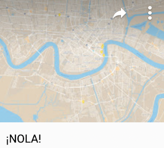
I bring a lot of maps into these classes and I have students bring in even more. The simple ¡NOLA! map shows just one kind of thing: the locations of international consulates in New Orleans. It seems to have a lot of consulates for a city its size, and they are not random. Rather, they reflect the places to which New Orleans has had -- and continues to have -- the most important connections through trade, migration, and cultural exchange.

The Chan Chan map is similar to some of the others mentioned so far, in that it shows the places mentioned in a work of art, in this case a song by the same name. Not just a song, though: the song that has come to represent an important moment in Cuban music and the performers who represent that moment: Buena Vista Social Club. In this case, the map arose from my own curiosity about the song -- I could not decipher its meaning until I figured out which words were place names. I embedded the map in my 2013 Hoguín Son post. (That is the Spanish word "son" for "sound" not the English word for a male heir.)


I made the Garifuna map for students in my New Orleans class. It has just three points, but they are important for understanding the geography of Garifuna language and culture in the Caribbean region. 


I hope that people are still aware of the story of Malala Yousef, a Pakistani woman who was nearly killed about a decade ago for pursuing an education and whose courage captured the imagination of millions. My first blog post about her was my 2014 Crisp and Self-Assured, which had to do with pundits like Rush Limbaugh supporting her attackers. When I wrote Riveting Malala a bit later that year, I created the map Malala Locations from the Memoir, because her book mentions many places that are not at all familiar to most of her readers. As with any of my maps, the idea is not simply to notice where the points are, but rather to use these maps as a point of departure for further exploration. Once we know where various events in her life took place, we can use these and other maps to learn more about those places. Are they hot, dry, steep, flat, forested, urban, rural -- what kinds of places are they?


The Malbeclipse 2019 map describes personal travel with a complicated story that began with a jury-duty summons two years prior. Pamela had received a summons for federal jury duty that would have disrupted the long-planned (and very geographic) celebration of our 30th wedding anniversary. The feds let her off the hook, but stressed that there would be NO MERCY during the make-up week a few months later. So when friends invited us to return to their home in Kearney, Nebraska for a total eclipse of the sun, we declined so that Pam could call the court every night. 

Salta is on the map for next time!
Image: Descubre Argentina 
Of course, she was never seated on that jury, but our hopes were dashed. This geographer immediately set about searching upcoming eclipses and noticed that a 2019 event would be very close to Mendoza, Argentina -- an Andean town that is the source of most of the red wine we drink in our home -- Mendoza Malbec. As we were making plans, I was fortunate to meet someone from Chile who convinced me that the Elquí Valley of Chile would be a better viewing area. It is home to one of the world's most important clusters of astronomy researchers because of the incredibly clear skies at the edge of the Atacama Desert. So the question was: Argentina or Chile? The answer was: yes, both. We went to Chile for the eclipse and then flew to Argentina for the wine. We did not lack for wine on the Chilean side of the mountains of course, but we had our hearts set on Mendoza!  The Malbeclipse 2019 map includes some details about our lodging and transportation and also the half dozen or so vineyards we visited. 

Bonus: I just added an icon to this map for our next visit. We need to return to both sides. I would love to spend a month or so in Elquí and we also need to get to the Gabriela Marquez museum that was closed the day we tried to visit. 
On the Argentine side, we visited quite a few vineyards, including one in the distinct Uco Valley district to the south of Mendoza proper, but we left about 250 vineyards unvisited. We were also there in southern winter, and I wonder how crowded the entire area must be in peak season. The icon I have added is not for any particular vineyard in Mendoza -- though we do have some favorites. Rather, it is for another growing area -- even higher in elevation and well to the north: Salta. We have had a few exquisite wines from there. Moreover, an image I recently found on the Descubre Argentina tourism site suggests the kind of alpine village scene I had imagined but not found in Mendoza. I'm willing to give it a try!


Onyema Ogbuagu is a map that is named for a person -- a person whose name recognition is tiny (even I had forgotten why I made this map) despite the immense importance of his contribution to global well-being.  As I mentioned in my 2020 Thanks to Doctor Ogbuagu blog post, he is a Yale researcher who played a vital role in the development of a Covid-19 vaccine that saved millions of lives and allowed billions of people to return to something like normal living after the global pandemic. His biography mentioned several academic sites throughout Nigeria that were unfamiliar to me, so of course I made a map!


Those who click on my Georgia Planning map (and I hope that includes whomever is reading right now) will notice that this is, as we say, Georgia the country, not that place where we keep Atlanta. This is the former Soviet republic on the Black Sea that a certain crazy man in Moscow has made some efforts to reconquer. It is mountainous country of great political and geological complexity, considered equally Asian and European -- neither and both, in the minds of many.

We have been learning a lot about Georgia since 2017, when we hosted a Georgian geologist in our home for a couple of months while he used our university's facilities for some fascinating work trying to untangle some of that geology. We were fortunate that he returned for a brief visit a couple years later and that we have stayed in touch online. (No worries -- on our part -- that Georgian is an extremely unusual and difficult language. Our friend Luka is fluent in at least four languages, one of which is English!)

Among the interesting things we have learned is that Georgia is the FIRST place on the planet to have made wine; those who have been paying attention will know that this alone is reason enough for a Hayes-Bohanan visit. We are also interested in some outreach related to geography education and simply visiting Luka and other Georgian friends in their home country. So far this is a planning map with no date (Covid-19 threw us off some former plans), but definite strong intentions. (Fun fact: Tbilisi is one of three national capitals on the same latitude as our home near Boston.)


The Puerto Rico 2016 map began as a planning map but now serves as an annotated record of our visit that year, including a link to all of my photos from the journey. So far this is the only time any of the Hayes-Bohs have visited the island, which would be the 51st state already, were it not for the opposition of Kentucky Senator Mitch McConnell, our country's most effective bigot. 

Our son went to the sort of school where the parents' fundraising auction included fancy vacations, and we decided to splurge on an offer of a few days in a villa on the north coast of the island. It is not the sort of place we would normally vacation on our own -- the offer was somewhat off-season, so we had not only a huge villa but almost an entire gated community to ourselves. No complaints, though: it was beautiful, comfortable, near the ocean, and convenient for exploring much of the rest of the island. 

The map includes a description of each of the sites we were lucky enough to visit, a year before Hurricane Maria and a criminally negligent federal response destroyed many of these sites. A search of this blog for the word Boricua points to more of my pointed remarks about the treatment of my fellow citizens on the quasi-colonial island. I also recommend the documentary Yo Soy Boricua Pa'Que Tu Lo Sepas! (I'm Boricua Just So You Know) by comedienne Rosie Perez -- see IMDb entry or the entire film on YouTube. It was made in 2006 but remains the best introduction I know to the island and its connections to the mainland.

Just added in Spring 2026: HBA means Hayes-Boh Airports (it is also the real code for Hobart, Australia). 


This map locates every airport to or from which I have flown -- either as a destination or as a layover. Each one has a story! There are also just a few airports where I have not been a passenger, but for which I have a comment -- these are in orange.


I am fortunate to have lived in many parts of the United States and briefly in Mexico, Brazil, and Nicaragua. The Todas las Casas map locates all of these homes. This includes nine "Love Shack" locations with my spouse. It was Love Shack #9 to which we returned one evening, after hearing these folks perform the song in our favorite theater. 

A related map is on my Trip Advisor profile -- it shows many of the places I have visited.

MAPS TO COME!!  I have a few more to share, and I often get motivated to make new ones. There is no better form of procrastination for a geographer with a nostalgia problem.


Blog Ideas

coffee (25) GEOG381 (24) GEOG388 (23) GEOG470 (18) climate change (18) GEOG130 (16) geography (16) GEOG332 (13) GEOG431 (12) musica (11) GEOG 332 (9) GEOG 381 (9) Mexico (9) Brazil (8) GEOG286 (8) Texas (8) education (8) migration (8) GEOG298 (7) borderlands (7) GEOG199 (6) GEOG331 (6) Massachusetts (6) US-Mexico (6) deBlij04 (6) immigration (6) GEOG 130 (5) GEOG 286 (5) GEOG287 (5) climate justice (5) cultural geography (5) fair trade (5) food (5) geographic education (5) nicaragua (5) water (5) Arizona (4) GEOG 171 (4) GEOG171 (4) GEOG295 (4) Safina (4) africa (4) deBlij05 (4) land protection (4) music (4) politics (4) Bolivia (3) Boston (3) COVID-19 (3) Detroit (3) Ethiopia (3) Managua (3) Obama (3) border (3) cartography (3) drought (3) libraries (3) pesticides (3) suburban sprawl (3) trade (3) unemployment (3) Alaska (2) Amazon (2) Bridgewater (2) Canada (2) Chiapas (2) China (2) Colonialism (2) EPA (2) EarthView (2) Economy (2) Environment (2) GEOG 199 (2) GEOG 287 (2) GEOG 388 (2) Google Maps (2) Government (2) Hawaii (2) India (2) Lexington (2) Maldives (2) Mozambique (2) NOLA (2) NPR (2) National Monuments (2) National Parks (2) New Orleans (2) Religion (2) Rio Grande (2) Taunton River Wild and Scenic (2) Tex-Mex (2) The View from Lazy Point (2) United States (2) Venezuela (2) anthropocene (2) cape verde (2) censorship (2) central america (2) chocolate (2) corn (2) deBlij07 (2) deforestation (2) demographic transition (2) demography (2) education reform (2) employment (2) environmental geography (2) film (2) forest fire (2) global warming (2) islands (2) landscape ecology (2) librarians (2) maps (2) organic (2) peak oil (2) refugees (2) sense of place (2) soccer (2) sustainability (2) television (2) water rights (2) whales (2) #bbc (1) #nicaragua (1) #sosnicaragua (1) #sosnicaragua #nicaragua (1) 100 Years of Solitude (1) ACROSS Lexington (1) Accents (1) Adam at Home (1) Alice (1) Alt.Latina (1) American Hustle (1) April (1) Association of american Geographers (1) Audubon (1) Aunt Hatch's Lane (1) BBC (1) BSU (1) Baby Boomers (1) Banda Aceh (1) Bay Circuit Trial (1) Bechtel (1) Beleza Tropical (1) Belize (1) Beloit College (1) Ben Linder Cafe (1) Bet The Farm (1) Bhopal (1) Biafra (1) Bikeway (1) Bikini (1) Bill Gates (1) Bill Moyers (1) Boeing 777 (1) Brazilian (1) Brazilianization (1) Bridge (1) British Columbia (1) Brockton (1) Bus Fare (1) Bush (1) Cabo Verde (1) California (1) Cambridge (1) Cape Cod Bay (1) Carl Stafina (1) Catholic (1) Ceuta (1) Chalice (1) Chipko (1) Citgo (1) Climate risks (1) Cochabamba (1) Colombia (1) Common Core (1) Commuter (1) Computers (1) Cuba (1) Cups and Summits (1) Dallas (1) David Byrne (1) Deans Beans (1) Delaware Valley (1) Dunkin Donuts (1) Earth Day (1) Earth View (1) Easton (1) El Salvador (1) Elizabeth Warren (1) Ellicott City (1) Emilia Laime (1) English-only (1) Environmental History (1) Euphrates (1) European Union (1) Evo Morales (1) FIFA (1) FYS (1) Fades Out (1) Farms (1) First-Year Seminar (1) Food Trade (1) Frederick Kaufman (1) French press (1) Fresh Pond Mall (1) GEOG 431 (1) GEOG 441 (1) GEOG213 (1) GEOG490 (1) Gabriel García Márquez (1) Garden of Gethsemane (1) Gas wells (1) Gateway Cities (1) General Motors (1) Gini Coefficient (1) Girl in the Cafe (1) Google (1) Gordon Hempton (1) Gravina Island Bridge (1) Great Migration (1) Great Molasses Flood (1) Guy Lombardo (1) Haiti (1) Hawks (1) Heart (1) Higher Education (1) History (1) Holyhok Lewisville (1) Homogenous (1) Honors (1) How Food Stopped Being Food (1) Hugo Chavez (1) IMF (1) Iditarod (1) Imperial Valley (1) Income Inequality (1) Indonesia (1) Iraq (1) Irish (1) Japan (1) Junot Diaz (1) Kenya (1) Ketchikan (1) Key West (1) Kindergarden Students (1) King Corn (1) Kiribati (1) Latin America (1) Limbaugh (1) Literature (1) Living On Earth (1) Louisiana (1) Love Canal (1) Luddite (1) M*A*S*H (1) MCAS (1) MacArthur Genius (1) Maersk (1) Malawi (1) Malaysia (1) Malaysian Air Flight 370 (1) Mali (1) Manu Chao (1) Map (1) Marblehead (1) Mary Robinson Foundation (1) Maryland (1) Massachusetts Bay Colony (1) Math (1) Maxguide (1) May (1) Maya (1) Mayan (1) Mayan Gold (1) Mbala (1) McDonald's (1) Melilla (1) Mexicans (1) Michael Pollan (1) Michelle Obama (1) Micronesia (1) Military (1) Military Dictatorship (1) Minuteman Trail (1) Mongolia (1) Monsanto (1) Montana (1) Morocco (1) Mount Auburn Cemetery (1) Muslim (1) NPS (1) Nantucket (1) National Education Regime (1) Native American (1) Native Americans (1) New Bedford (1) New Hampshire (1) New York City (1) New York Times (1) Nigeria (1) No Child Left Behind Act (1) Norquist (1) North Africa (1) Nuts (1) Oakland (1) Oaxaca (1) Occupeligo (1) Occypy (1) Oklahoma (1) Oklahoma City (1) Oppression (1) PARCC (1) Pakistan (1) Pascal's Wager (1) Peanut (1) Pearson Regime (1) Philadelphia (1) Philippines (1) Pink Unicorns (1) Poland (1) Portuguese (1) Protest (1) Public Education (1) Puebla (1) Puritans (1) Quest University (1) Rachel Carson (1) Reading (1) Republican (1) Retro Report (1) Robert Reich (1) Rock Legend (1) Ronald Reagan (1) Rondonia (1) Rosa Parks (1) SEXCoffee (1) Safety (1) Samoza (1) Sandino (1) Sara Vowell (1) Save the Children (1) Scotch (1) Scotland (1) Seinfeld (1) Senegal (1) Sergio Mendes (1) Severin (1) Sharrod (1) Silent Spring (1) Sinatra (1) Slope (1) Smokey the Bear (1) Somalia (1) Sombra (1) Sonora (1) Sonoran desert (1) Sonoran hot dog (1) South America (1) Spain (1) Stairway to Heaven (1) Storm (1) Suare Inch of Silence (1) Sumatra (1) Swamp (1) Tacloban (1) Tanzania (1) The Amazon (1) The Amazon Trail (1) Tigris (1) Tucson (1) Tufts (1) U.S Federal Reserve (1) U.S Government (1) U.S. economy (1) USDA (1) USLE Formula (1) Uganda (1) Unfamiliar Fishes (1) Union Carbide (1) Vacation (1) Vexillology (1) Vietnam (1) ViralNova (1) WNYC Data News (1) Wall Street (1) Walsenburg (1) Walt Disney (1) Walt and El Grupo (1) Ward's Berry Farm (1) West (1) Whaling (1) Wilson (1) Winter Storm Saturn (1) Wisconsin (1) World Bank (1) Xingu (1) YouTube (1) Zombies (1) agriculture (1) antitrust (1) aspen (1) austerity (1) aviation (1) banned books (1) bark beetle (1) bean (1) beavers (1) bicycle (1) bicycling (1) bike sharing (1) binary (1) biodiversity (1) bioneers (1) books (1) boston globe (1) cacao (1) cafe (1) campaign (1) campus (1) cantonville (1) capitals (1) carbon dioxide (1) carbon offsets (1) carioca (1) cash (1) cashews (1) census (1) chemex (1) chemistry (1) chronology (1) churrasco (1) civil rights (1) coffee grounds (1) coffee hell (1) coffee prices (1) coffee quality (1) college (1) compost (1) computerized test (1) congress (1) conservation commission (1) corporations (1) countries (1) cubicle (1) dams (1) deBlij06 (1) deBlij08 (1) death (1) deficit (1) development (1) dictatorship (1) distracted learning (1) distraction (1) drug war (1) dtm (1) earth (1) economic diversification (1) economic geography (1) election (1) embargo (1) energy (1) enhanced greenhouse effect (1) environmentalist (1) ethnomusicology (1) exremism (1) failed states (1) farming (1) financial crisis (1) football (1) forestry (1) forro (1) fracking (1) free market (1) free trade (1) fuel economy (1) garden (1) genocide (1) geography education (1) geography games (1) geography of chocolate (1) geography of food (1) geologic time (1) geotechnology (1) gerrymandering (1) global pizza (1) globe (1) goodall (1) green chemistry (1) ground water (1) guacamole (1) guatemala (1) habitat (1) high-frutcose (1) home values (1) hospitality (1) hourglass (1) housing (1) hydrology (1) illegal aliens (1) income (1) indigenous (1) interfaith (1) journalism (1) kitchen garden (1) labor (1) language (1) libertarianism (1) library (1) linguistics (1) little rock (1) llorona; musica (1) macc (1) maccweb (1) magic realism (1) maple syrup (1) mapping (1) masa no mas (1) massland (1) medical (1) mental maps (1) mi nina (1) microlots (1) microstates (1) mining (1) mltc (1) monopoly (1) municipal government (1) nautical (1) neoclassical economics (1) new england (1) newseum (1) newspapers (1) noise pollution (1) pandas (1) petroleum (1) piracy (1) pirates (1) poison ivy (1) police (1) political geography (1) pollution (1) provincial government (1) proxy variables (1) public diplomacy (1) quesadilla (1) rabbi (1) racism (1) real food cafe (1) regulations (1) remittances (1) resilience (1) resistance (1) respect (1) rigoberta menchu (1) rios montt (1) romance (1) roya (1) runways (1) russia (1) satellites (1) science (1) sea level (1) selva negra (1) sertao (1) sertão (1) sex (1) sex and coffee (1) simple (1) sin (1) smokey (1) solar (1) solar roasting (1) south africa (1) sovereignty (1) species loss (1) sporcle (1) sports (1) state government (1) taxes (1) tea party (1) teaching (1) textile (1) texting (1) tortilla (1) training (1) transect; Mercator (1) travel (1) triple-deckers (1) tsunami (1) urban geography (1) utopia (1) vermont (1) vice (1) video (1) wall (1) water resources (1) water vapor (1) whiskey (1) whisky (1) widget (1) wifi (1) wild fire (1) wildfire (1) wildlife corridor (1) wto (1)